Skip to main contentResource added 
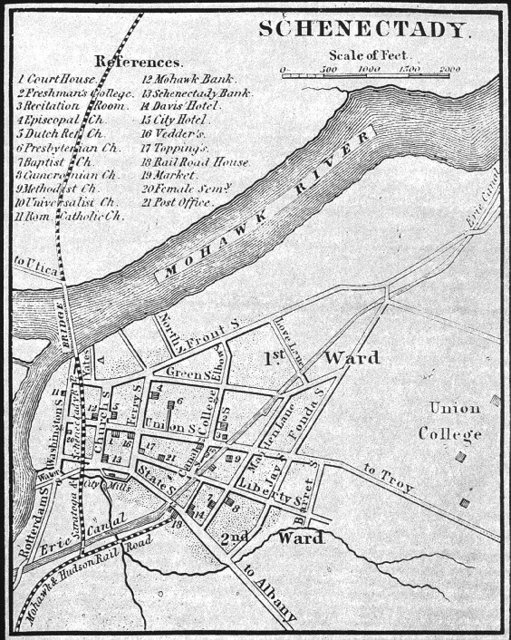
Map of City of Schenectady, Gordon's Gazetteer, 1836
Full description
Attached is a map showing the city of Schenectady, N.Y. From this, you can see that the Erie Canal ran through the city at what is presently Erie Ave. Union College's boundaries are clearly shown, as well as other locations that Pearson makes mention of in this diary entry.
Map courtesy of http://www.schenectadyhistory.org/schenectady/index.html.
Comments
to view and add comments.
Annotations
No one has annotated a text with this resource yet.
- typeImage
- created on
- file formatjpg
- file size192 kB